Natural and uncontrollable influences
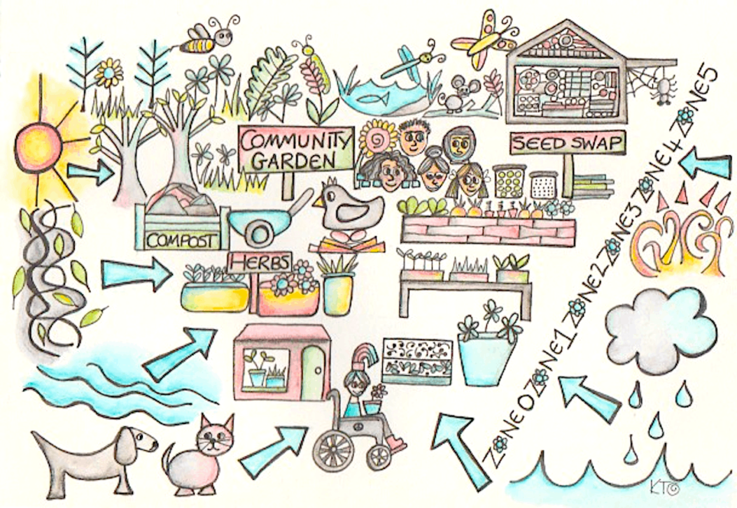
What is permaculture sector analysis? With sector analysis in permaculture, the term sector refers to any natural or uncontrolled influence that moves through your design site. And through sector analysis, you can anticipate and enact design decisions that will mediate, mitigate, and improve how those uncontrolled influences affect your site.
Sectors could be wind, water, weather… they can be economic, social, biological, or any combination of the above. Every sector has needs, resources, yields, wastes, and relationships that influence the whole system.
A work-zone is a sector, with uses, yields, and wastes. A children’s play area is a sector, and has needs and resources associated with it. The cold, moldy side of the basement is a sector (AND permaculture microclimates – we’ll get to that in this article), with opportunities intrinsic (mushrooms, anyone?)“Invisible structures” are mostly sectors as well, and so is your “inner landscape.”
Every site, no matter where you are, has a complex labyrinth of sectors to consider when making choices about your design. Permaculture sector analysis will help you identify microclimates and discover opportunities that weren’t obvious at first glance. The more you know, the better decisions you can make.

Identifying risks and designing solutions
This section by Pippa Buchanan
The potential for disaster happens when systems can not handle extremes or cumulative stress. One week of limited spending may be a challenge, but a medical bill on top of long-term debt and structural poverty may force a family into homelessness.
Water is essential for life, but the extremes of either drought or flood-causing torrential rain can cause havoc in both natural and human systems.
Designing land, the built environment, lifestyles, livelihoods and organizations to deal with extremes as well as everyday conditions is essential for resilience. There are many ways in which permaculture design and practice supports resilience, but in order to do that, it is important to understand what extremes are most likely to have an impact.
This is why careful observation and permaculture sector analysis is so important for a successful project.
Permaculture sector analysis is a critical tool for visually representing observations about the “sectors” or external forces and elements that move through or otherwise influence your project. The sectors you record can be related to effects on the site caused by climate, ecology, geology, topography and society.
For example, sun paths, wind and rain patterns, invasive plants, wildlife, pollution, neighbors, areas of high fire threat, views and noise could all be recorded on your sector analysis layer.
Sectors are often represented as labelled wedges, arcs or arrows representing the origin and direction of the element. However, rocky areas, contaminated soil, boggy land, or areas of flood risk are better represented as location specific patches over your permaculture base map.
Some uncontrollable issues such as geological instability or limiting factors such as legal restrictions are harder to represent visually and are best recorded in writing.
Permaculture sector analysis often represents the origin of different forces through arcs
Part of developing a Designer’s Mind is about making observations free of bias. The forces recorded on a sector analysis are neutral and can be both beneficial or harmful.
For example, knowing that dry summer winds come from the east helps identify the best place to locate a laundry line or to hang produce for drying. At the same time, that drying wind will quickly evaporate water from soil as well as dams or ponds.
This information guides the placement of windbreak plantings or hedges on the eastern side to moderate the impact of the wind and reduce evaporation.
Used together with tools such as zone analysis and common permaculture design principles, sector analysis helps guide the placement of components so that they make the best use of or mitigate the risks of that sector.
Permaculture zones explained
Permaculture sector analysis influences which zones are placed where, but at the same time, zones influence the strategies used to respond to external forces. In outer zones such as 3 or 4, lower cost, less energy intensive solutions such as windbreak plantings are used to slow the wind.
Closer to the home (permaculture zone 0 and permaculture zone 1), more intensive solutions such as walls or use of gray water might be used to protect water-demanding plants, animals and people from a drying wind.
You should make a sector analysis for your overarching project, and you should also make analyses for sub-designs such as high intensity vegetable beds that include smaller scale microclimate influences like the impact of trees casting shade.
Working on sector analysis is a great way to review and incorporate the ideas from everything else you’ve been seeing and learning. Your sector analysis should help you identify the risks, or major extremes that will threaten the longevity of your design projects whether they be fire, flood, drought or legal challenges.
Want to learn more about this and other topics related to permaculture, sustainability, and whole-systems design?
We offer a range of FREE (donations optional) online courses!
Relevant Links and Resources
In the video above, one of the things Pippa talks about is apartment-scale sector analysis.
By contrast, here’s a discussion of farm scale sector analysis, from the folks at Grass-fed Homestead.
This is a detailed, excellent video about how to make a permaculture sector analysis, from Steve Gabriel of Wellspring Permaculture. He is using Illustrator, which is not free and fairly complicated, but you can for sure translate the knowledge here to hand-drawn maps and/or a free tool like Autodesk Sketchbook.


